


VesselFinder

Description of VesselFinder
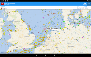
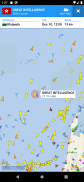
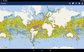
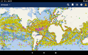
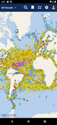
VesselFinder is a vessel tracking application that provides real-time data on the positions and movements of ships across the globe. This app, popular among maritime enthusiasts and professionals, allows users to track over 200,000 vessels daily. VesselFinder is available for the Android platform, making it accessible for users who wish to download the app for enhanced maritime tracking capabilities.
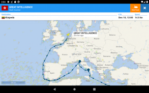
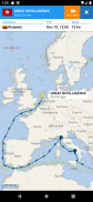
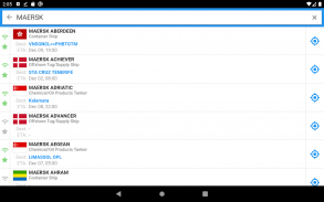
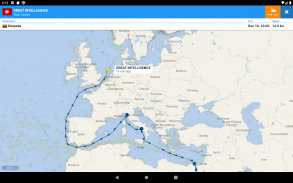
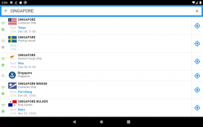
Users can search for ships using various identifiers, including name, IMO number, or MMSI number. This functionality enables quick access to detailed information about specific vessels. The app also offers a history of ship movements, allowing users to view past positions and routes taken by individual ships. This feature is particularly useful for those monitoring vessel traffic or conducting research on maritime operations.
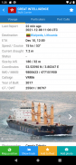
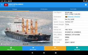
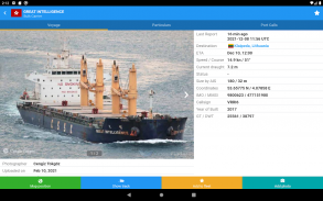
In addition to vessel tracking, VesselFinder provides detailed ship information such as the vessel's name, flag, type, IMO, MMSI, destination, estimated time of arrival (ETA), draught, course, speed, gross tonnage, year built, and dimensions. This comprehensive data allows users to understand the characteristics and operational status of the vessels they are tracking.
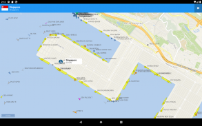
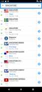
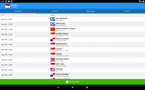
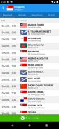
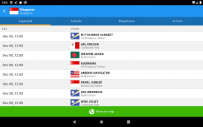
Port searches are another significant aspect of VesselFinder. Users can search for ports by name or LOCODE, facilitating easy access to information about various maritime hubs. The app includes detailed lists of port calls for each ship, which detail the time of arrival and duration of stay in ports. Similarly, users can view port calls for specific ports, giving insight into all vessels that are expected, arriving, departing, or currently in port.
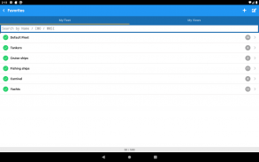
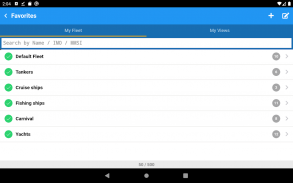
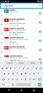
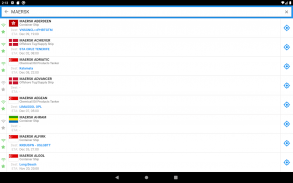
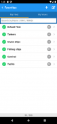
The app also features a "My Fleet" functionality, allowing users to add their favorite vessels to a personalized list. This feature is synchronized with the user's VesselFinder account, making it easier to monitor selected ships without needing to search for them repeatedly. Furthermore, users can save their preferred map views with the "My Views" option, providing quick navigation to often-visited locations.
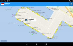
VesselFinder includes a variety of map options, including Simple, Detailed, Dark, and Satellite maps. This variety allows users to choose the visual representation that best suits their preferences or needs. In addition to standard maps, the app has weather layers that display real-time information on temperature, wind, and wave conditions. This feature enhances the user experience by providing additional context for vessel movements and conditions at sea.
For those interested in measuring distances, VesselFinder includes a distance measure tool. This tool can be useful for various purposes, such as calculating the distance between two vessels or assessing the proximity of a ship to a particular port.
The app allows users to see their own location on the map, which can be particularly beneficial for those who work in or around maritime environments. This feature ensures that users are always aware of their position relative to nearby vessels and ports.
User-generated content adds another dimension to VesselFinder. The app enables users to contribute photos of vessels, creating a community-driven database of ship images. This feature can be particularly engaging for maritime enthusiasts who enjoy sharing their experiences and observations with others.
VesselFinder's reliance on AIS (Automatic Identification System) signals means that the visibility of vessels in the app is subject to AIS signal availability. When a vessel is outside of the AIS coverage zone, the app displays its last reported position and updates the information as soon as the vessel comes back into range. While this dynamic approach helps in tracking vessels, it is important to note that the completeness and accuracy of the information provided cannot be guaranteed.
VesselFinder is an essential tool for anyone interested in maritime activities, whether for personal use, professional purposes, or research. Its extensive features cater to a wide range of users, from casual enthusiasts to industry professionals who require precise tracking and vessel information.
The app’s comprehensive ship and port data, coupled with real-time tracking capabilities and user-friendly interface, makes it a valuable resource for those engaged in maritime navigation and observation. By downloading VesselFinder, users gain access to a wealth of information that enhances their understanding of global maritime movements.
Connect with VesselFinder on Facebook at http://www.facebook.com/vesselfinder or follow them on Twitter at http://www.twitter.com/vesselfinder for updates and community engagement.

VesselFinder - APK Information
APK Version: 5.8.7Package: com.astrapaging.vffLatest Version of VesselFinder
Other versions


Apps in the same category


